Mt Franklin Matterhorn of the Brindabellas? That got your attention.
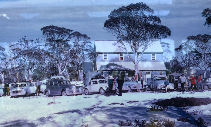
Clic-bait, sure. But Mt Franklin was the pinnacle of Canberra skiing from the 1930s to the 1960s, home to the largest ski area north of the Snowy Mountains (not exactly hard!) and an iconic club ski lodge. Yes, Canberra had ski in/ski out only 65km from the city centre.
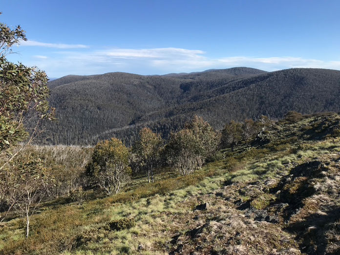
If you are trying to spot Mt Franklin from Canberra it is a pointy stand alone summit, sticking up to 1646m. Not quite Matterhorn-pointy to be sure, but pointy enough to make it stand out.
It’s actually hidden from view many places around Canberra by the rugged bulk of the Tidbinbilla Range, which is only 50m lower. One good view direct to Mt Franklin can be had from the War Memorial steps.
They used to hold inter-club ski races here, and it could get so much snow people got stuck for days at a time.
I can remember skiing it with knee deep powder and a big cornice built up in 1995.
Back for the first time in over 20 years yesterday, on a hot day as summer starts to arrive, it was hard to believe they ever got that much snow. These days snowfalls along the Brindabellas seem to melt off in no time, so you would need to be lucky with an accumulation of a dump, a freeze to pack it down, and more on top for a hope of ski-ability.
The old runs were already pretty overgrown 25 years ago; they are much more so now.
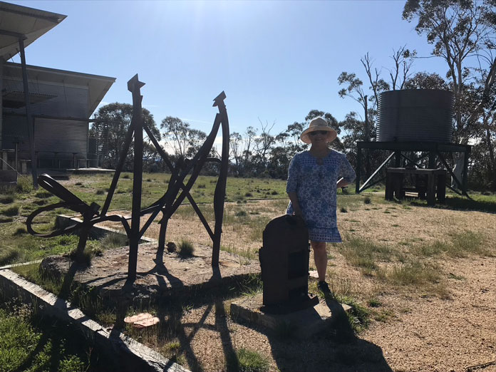
The disastrous 2003 bushfires destroyed the old Canberra Alpine Club ski lodge which was the hub for plenty of great ski and aprés ski times. Five years later the existing emergency shelter cum interpretative centre was built next to the old lodge site.
The shelter has some interesting reference boards telling the story of the ski years. For more detail on that find a copy of historian Matthew Higgins 1994 ‘Skis on the Brindabellas’ book, which documents the story of skiing here in detail. Mr Mountain Huts, Klaus Heuneke’s Tabletop Press, may be able to find you a copy.
It’s a nice spring, summer or autumn drive from Canberra, about 65km from the city centre via Cotter or Uriarra Crossing.
The Brindabellas are a spectacular mountain range, peaking out at 1911m at Mr Bimberi – which is higher than the summit of Hotham or Buller (sorry Victorians).
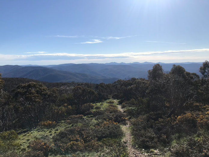
Mt Franklin is almost as far along the range as you can go by car. There’s a locked gate at Mt Ginnini 4km further on. The Royal Military College (Duntroon) used to have their own ski lodge and tow there too. If it does snow heavily or for bushfire hazard over summer gates may be shut earlier – the big sign back on the bitumen at the start of the climb tells you where the road is open to. It’s a good wide if windy 2 lane bitumen road up to 5km before Picadilly Circus junction – continue right to drop down into the Goodradigbee River Valley, and on to Tumut, or left to Bulls Head Shelter and picnic/camping area and on to Franklin.
The road past Bulls Head is OK for 2WD in normal conditions, but after heavy rain it can get ugly. At the best of times there are potholes and loose stones in sections so take it easy. Take it easy even if you have a big 4WD; there are lots of blind corners on the last 20km narrow section to Franklin, and plenty of locals like Copperhead snakes, skinks and rock wallabies crossing the road, so slow down and don’t kill anything. Plus it’s nice to wind down the windows and listen to the birds.
There’s a pull in carpark beside the road, with a 200m walk up to the old lodge site and the new shelter. After recent rains the water tank was full of fresh rainwater, but you should take your own water. There’s a toilet too.
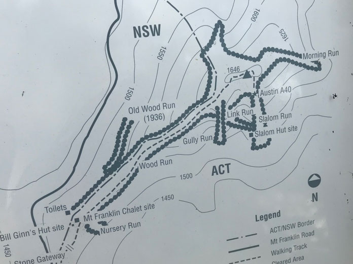
From the shelter it’s an easy, but bit steepish, hike up to the Trig Station and the tops of the main old ski runs. A rusting A-40 that served as the tow-station and some old rope tow stakes and pulleys remain as reminders of the good old days a bit further over past the trig.
Hiking and jogging up the track in shorts and a t-shirt I was thinking it must have been harder work back in the day with long skis. I can’t remember if we hiked or skinned up in 1995, or find the photos to prove it, so you’ll have to trust me!
The home run back beside the track to the old base is overgrown with scrub now. It would take a solid metre of snow to make things very skiable again. Over the front side from the top, the old ‘Morning Run’ has a view back to Canberra, which would make a nice shot if it ever does snow enough again to get it.
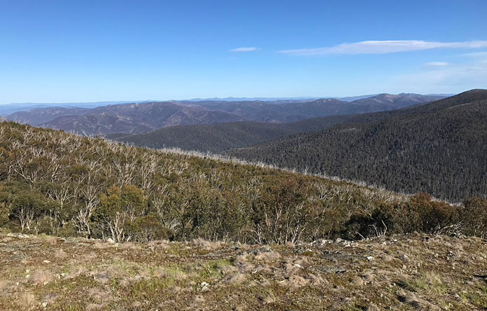
Meantime for anyone who lives or is visiting the Canberra area Mt Franklin is just a magnificent drive and hike.
The views are wild and panoramic from the peak and the road, which dips back and forth over the east and west sides of the range. Being 1000m or so above the city it’s pretty fresh even on a stinking hot day.
Take a picnic. If there are no fire bans you can use the fires with cooking plates at the Bulls Head Shelter 20km before Franklin. Bulls Head would be a good spot to do it on MTBs from too if you are fit.
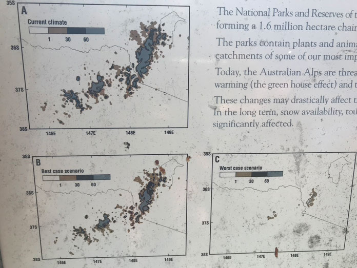
Before getting into skiing in the 80s, I used to bushwalk a lot in the Brindabellas back in the late 70s, which is closing on 50 years ago. So looking at the poster display at the shelter showing the CSIRO’s “Best Case” and “Worst Case” scenarios for days with snow cover in 2070 I can already relate to that. It’s sad to think there will be much less snowfall on the Brindies in decades to come.
Just in the 25 years since I last skied at Franklin the cover seems to have shrunk, with less snowfall days and far less snow accumulation. Regardless of that, go take a look and get a feel for what it was like up there over summer. If you are nearby in winter and it does dump, why not check it out?
Back then my mate’s brother worked for the ACT water authority, and had keys to locked gates up the Cotter River catchment, so we made it up via his secret short cut in an hour or so. These days better to check with ACT Parks for what is open or not in Namadgi National Park.
But no Franklin is not the end of lift accessed skiing as we know it in the ACT.
In fact, Canberra has just got it’s first chairlift – got as in arrived there, not got as in installed and working – check the latest and some more history on Corin Forest, whose original founders actually had plans to redevelop Mt Franklin 40 years ago!
