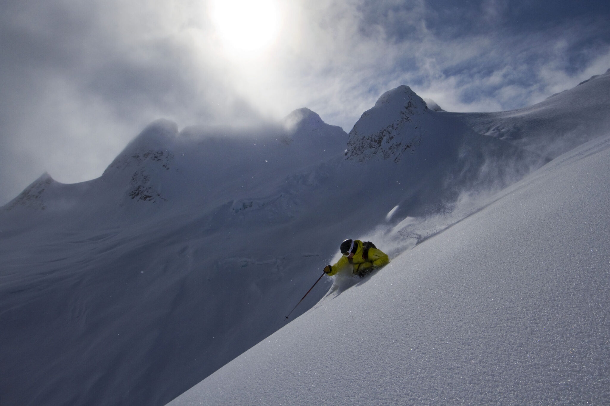
Anyone skiing the LWE got a reminder just how congested snow access can be in NSW.
Lockdowns have reduced congestion temporarily through the school holidays, but when they end it’s going to get crazy again.
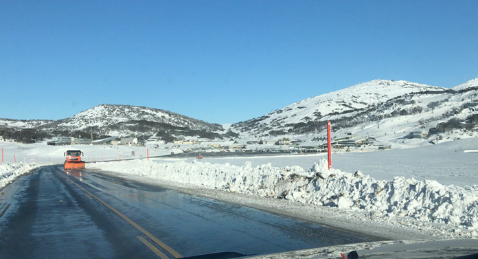
One frustrated traveller on the Sunday of the LWE gave up getting from Jindabyne to Perisher in the morning, after several hours trying, then turned around and eventually got on snow at Thredbo at 2:30pm. Keen.
Utah has also been experiencing ever growing congestion problems, especially for access to Snowbird and Alta resorts up Little Cottonwood Canyon from Salt Lake City.
So the Utah Transport authority, UDOT, have developed comprehensive plans to relieve this and improve reliability of access. After much discussion, they have released a draft EIS with two core options, which are open for public discussion now.
Either option sounds like an in-principle viable solution for our own access problems to Perisher and Thredbo too.
So let’s check them out, and their applicability to the local situation in NSW.
The glitzy option for Snowbird and Alta access is a fast gondola system up the valley.
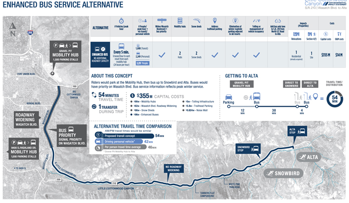
The simpler option adds a bus only shoulder lane with services every 5 minutes at peak times.
The main pros and cons of each from UDOT are outlined below.
A gondola would be a huge ask to get up in the NSW situation.
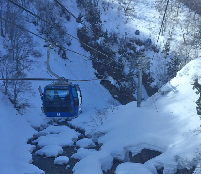
But it would work a treat running up the valley from Skitube to Thredbo. It would be something like the Dragondola from Naeba to Kagura in Japan which needs higher towers going over ridgelines there, but along the Thredbo Valley you would only need to be lower down, like the river section of the Drgaondola pictured here. It would be great for summer, bikers and hikers could use it. And if we want to dream really big, it would also be a way to open up Twin Valleys as a day-only ski resort option.
But realistically it won’t happen, so that leaves us with bus lanes.
Running dedicated buses to Skitube and Thredbo and up to Perisher would be pretty simple.
Eco friendly buses whisking people up and down the valley every few minutes would work well. You would need a lot of them presumably.
The UDOT proposal details 2 bus options, complete with all the hub etc details.
They envisage a dedicated bus lane either side of the road, but in NSW you could get away with just one dedicated lane for peak up & down periods – in the reverse direction there is almost zero traffic going the other way anyway, so empty buses could just use the normal lanes.
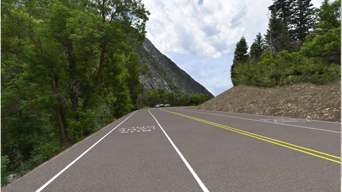
Bringing the Alpine Way from Jindabyne to Thredbo via Skitube up to 3 lanes with 1 bus lane would not be a huge deal. In summer the Utah proposal converts the bus lane to cycle/pedestrian use which would be ideal here too.
An even simpler immediate solution to alleviate road congestion is a one way traffic system at peak periods.
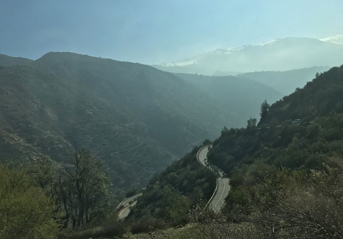
This is exactly what happens from Santiago, a city of 8 million people, up to the resorts there. The access road there involves 40 hairpin bends from the edge of the city up to Farellones – El Colorado, then another 13 hairpin bends to Valle Nevado. Weekends and peak times there are set up and down transit times, which have functioned very well for years. The roads to Perisher or Thredbo are way, way easier to negotiate than this, so it would not be hard to implement at all.
It would be the simplest rapid solution to the congestion problem to the Perisher areas.
Carparking capacity can be simply addressed by online pre booked numberplate entry, which closes when booked out for any given day so no one else would try and drive up. KNP have just introduced online Annual Passes with digital number plate recognition so extending that system to day entry should not be a major drama. Annual Pass holders would need to register the days they were coming up prior.
Anyone missing out on a slot, or just not wishing to drive, would use the bus option &/or Skitube.
Sure, there are lots of contentious issues, but throwing it in the too hard basket doesn’t help solve anything. And as outlined above major improvements could be made almost immediately.
Nothing fundamental has changed to improve NSW ski resort access since Skitube went in 35 years ago.
But Australia’s population has exploded in that time.
The latest proposals from the NSW Governments “Special Activation Precinct Snowy Mountains” Draft Master Plan is currently on public display and available for comment until August. Check it out for yourselves here.
This plan essentially recycles the Perisher Village development with a year round focus idea, and includes yet more beds for Thredbo. They even suggest chopping the golf course from 9 holes to 6 to make way more accommodation on the mountain side of the river. So more and more people, even if a few more of them can stay on snow.
In terms of actual commitments to improve resort access the only definite items we found in the draft plan are the semi-bypass Southern Connector road for Jindabyne and sealing the remaining gravel road section to Guthega. The Southern Connector road idea is welcome, but a 2 lane route as proposed to avoid the town centre will inevitably choke up at busy times, probably worse than the existing 4 lane Kozi Road through town already does now. A 4 lane version with an overpass at Barry Way and a flyover intersection connection to the Kozi road before the Thredbo turnoff would cut the mustard. In the plan as it stands there is just a vague commitment to leaving a wide enough verge along the Southern Connector to allow for adding a lane later!
As for beyond Jindabyne, there are motherhood statements about access improvements, but nothing very specific at all.
Compare that to the detailed plans in place in Utah and you see we have a long way to go ..
The Little Cottonwood Canyon Draft EIS Options
Salt Lake City has more pressing problems, and they are certainly far more advanced with actual proposals to alleviate them. Check out the Utah situation in detail below.
Based on the technical analysis conducted, UDOT identified the Enhanced Bus Service in Peak-Period Shoulder Lane as the alternative that best improves mobility and the Gondola Alternative B (base station from La Caille) as the alternative that best improves reliability.
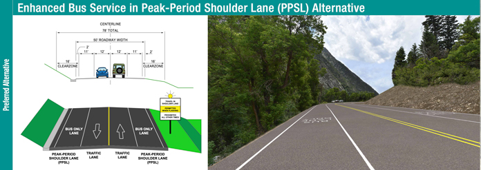
The Enhanced Bus Service in Peak-Period Shoulder Lane Alternative offers bus-only shoulder lanes on S.R. 210 (from N. Little Cottonwood Road to the Bypass Road) to be used during peak travel times. With this alternative, bus service is removed from congestion and able to pass slower moving traffic in the general-purpose lane, providing direct service to each destination. Those using the bus service would have the option of parking at either the gravel pit mobility hub (located at the mouth of Big Cottonwood Canyon) or at 9400 S and Highland, with a bus departing every 5 minutes to each ski resort. Of the alternatives examined, this alternative offers the fastest travel time, the second lowest cost and when not in use, the shoulders could be used by pedestrians and cyclists.
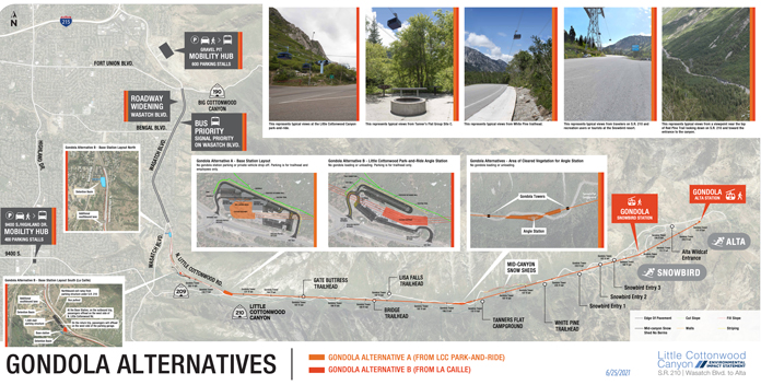
The Gondola B alternative would construct a base station approximately one mile from the mouth of Little Cottonwood Canyon (from La Caille) and offer direct service to each destination. Each gondola could hold up to 35 people and travelers could expect a cabin to arrive every two minutes. The Gondola base station includes 1,500 parking spaces, reducing the need for passengers to use bus service from the mobility hubs. The gondola alternative can operate independently of S.R. 210, avoiding delays related to snow removal, avalanche mitigation, crashes, slide offs and traffic. This alternative has the highest visual impacts but low impacts to wildlife movement, climbing boulders and the watershed compared to the other alternatives.
In addition to the preliminary preferred alternatives, other elements have also been developed that would be combined to support each alternative. These include snow sheds (concrete structures built over the highway to keep it clear of snow in case of avalanches); mobility hubs (larger-capacity park-and-ride lots with transit service); widening and other improvements to Wasatch Boulevard; tolling or single occupancy restrictions; addressing trailhead parking and eliminating winter roadside parking above Snowbird Entry 1.
Additional information on the preferred alternatives and these elements can be reviewed on the project website.
Check the video here on why – their pros/cons here